 |
||||
|
|
|
|
||
|
||||
|
|
|
|
||
| St Thomas Cemetery - Upper Mangrove Creek |
|||||||||||||||||
|
 |
||||||||||||||||
| Register: |
|
Map of
cemetery:
|
| Notes: | Cemetery is also known as "Upper Mangrove Creek Cemetery, Upper Mangrove Creek", "St Thomas Church of England Cemetery, Upper Mangrove Creek", "St Thomas Cemetery, Dubbo Gully" and "St Thomas Cemetery, Island Flat"
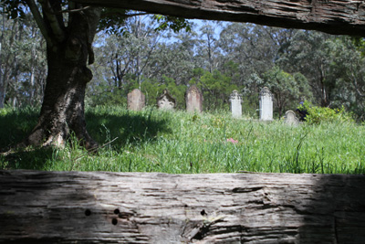
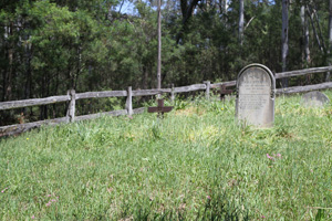
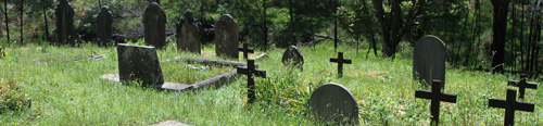
Above: View of St Thomas Cemetery looking back up towards the Ten Mile Hollow Road.
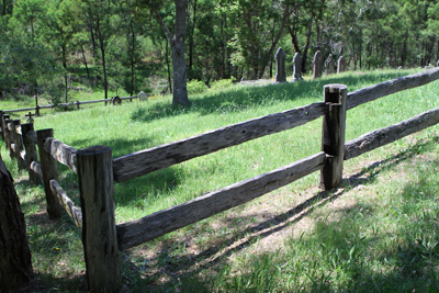
Above: Looking at the graves from Ten Mile Hollow Road.
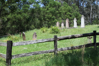
Above: View of St Thomas Cemetery.
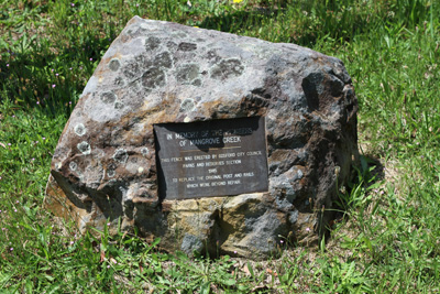
Above: Rock and plaque located at the entrance to the cemetery.
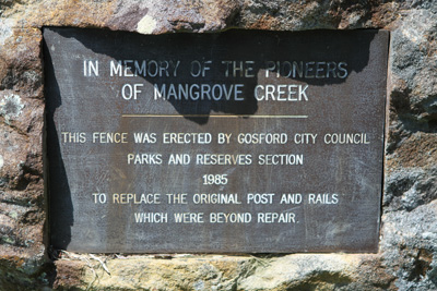
Above: Closeup view of the plaque at front of cemetery. Plaque reads as follows: IN MEMORY OF THE PIONEERS / OF MANGROVE CREEK / THIS FENCE WAS ERECTED BY GOSFORD CITY COUNCIL / PARKS AND RESERVES SECTION / 1985 / TO REPLACE THE ORIGINAL POST AND RAILS / WHICH WERE BEYOND REPAIR. |
|
| Credits: | Transcriptions and photography by Jonathan Auld and Michelle Nichols - October 2010. Transcribed on a tour of the Upper Mangrove Creek area hosted by the Dharug and Lower Hawkesbury Historical Society lead by Graham Nelson on 30 October 2010. | |
|
|
|
|
|
Copyright © 2000-2010 Hawkesbury on the Net Directory - all rights reserved |